Winter 2002
CONTENTS
AROUND THE OVAL
CLASS NOTES
ALUMNI NOTES
Contact Us
PAST ISSUES
Alumni Chat
|
Winter 2002 CONTENTS
AROUND THE OVAL Contact Us PAST ISSUES Alumni Chat |
Core Discovery�By Harry W. Fritz
Bozeman is a late entry. Lewis never saw it, but Clark came close. The headwaters of the Missouri River is an important site, but Lewis was worried when he arrived—still no Shoshone and now late in the season—and Clark was constipated. He was feverish, bilious, and had not had a passage in several days. Lewis prescribed five of Dr. Rush’s Bilious Pills, a particularly powerful laxative known as Rush’s Thunderbolts. Clark spent an extremely restless night, but he was up and about the next day. Other Montana cities are not even in the running. Only Missoula, deep in the confines of the Rocky Mountains, attracted Lewis and Clark.
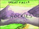
Contrary to general early American understanding, the Rockies are not a single, easily crossed chain of mountains. They are not the Appalachians, where one can pass from the Potomac to the Ohio watersheds in half a day. The Rockies are chain after chain of mountains—fifty-three separate chains in Montana alone. At this latitude they are 250 to 300 miles wide. Getting across, over, through, around the Rocky Mountains was the explorers’ sternest test. The journey consumed the entire summer of 1805, drew the expedition far off course, and derailed its carefully crafted timetable for reaching the Pacific and returning. Missoula is dead center in the middle of the northern Rocky Mountains. Look at a physiographical map of the Northwest and find Missoula. It is surrounded by mountains in all directions. Missoula is 100 miles from Lost Trail Pass, over the Bitterroot Mountains to the south. It is 100 miles from Lookout Pass, over the Bitterroots to the northwest. It is 100 miles from Rogers Pass, over the Continental Divide to the east, and 130 miles from Homestake Pass, over the divide to the southeast. When you get to Missoula, you’re halfway there. Meriwether Lewis figured all this out on his return trip through Montana in 1806. The previous season, on the outbound trip, the expedition had been, to put it bluntly, lost. Proceeding upriver on the Missouri from Great Falls, the Corps of Discovery was traveling south, not west, and getting farther away from the Pacific, not closer. The Jefferson and Beaverhead Rivers do not constitute a northwest passage. If you are going from Great Falls to Missoula, you do not usually visit Dillon. Standing on the Continental Divide at Lemhi Pass on August 12, 1805, Meriwether Lewis did not see the ocean. He did not see the Columbia River. He saw Idaho. Only in Idaho did Lewis at last encounter the Shoshone Indians. They were not at the great falls, not at Three Forks, not even in America. (Once the corps crossed the Continental Divide into what we now know as Idaho they were no longer in territory owned or claimed by the United States.)
When Lewis asked Cameahwait how to get out of Idaho, Cameahwait told him it was impossible. He described the Snake and Salmon Rivers, both impassable. Lewis didn’t believe him. He sent William Clark ahead with ten men to reconnoiter the “River of No Return.” Clark saw for himself the impossibility of floating the Salmon. Then, in an act of desperate independence, Clark hired an old Shoshone man, “Toby,” to guide the expedition across the mountains to navigable waters.
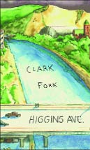
Coming rapidly down the Bitterroot River, and approaching Travelers’ Rest (modern Lolo), Toby redeemed himself. He offered the most significant bit of geographical knowledge that Lewis and Clark acquired anywhere on the entire trek. Toby’s observations deserve quotation. In Lewis’s words: “Our guide could not inform us where this river [the Bitterroot] discharged itself into the Columbia river he informed us that it continues it’s course along the mountains to the N. as far as he knew it and that not very distant from where we then were it formed a junction with a stream nearly as large as itself which took it’s rise in the mountains near the Missouri to the East of us and passed through an extensive valley generally open prairie which forms an excellent pass to the Missouri. the point of the Missouri where this Indian pass intersects it, is about 30 miles above the gates of the rocky mountain . . . the guide informed us that a man might pass to the missouri from hence by that route in four days.” Toby described a shortcut from Travelers’ Rest to the Missouri, across the top of the U-shaped route the expedition had followed. The “stream nearly as large as itself” is today’s Clark Fork of the Columbia, flowing through Missoula. The “extensive valley generally open prairie” is the Clark Fork and Little Blackfoot Valley, then over Mullan Pass and along the edge of the Prickly Pear Valley to the Missouri. Thirty miles above the Gates is just east of Helena. Today’s highway distance is about 135 miles. Four days is a long cry from the fifty-two days of rugged travel the expedition had just expended. Right then and there, Lewis and Clark decided that if they ever got back this way they would split up and try Toby’s route.
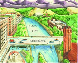
Flash forward now to July 1806. Lewis and Clark have returned to Travelers’ Rest, and the expedition divides. Clark takes a large party back to Three Forks, then east across Bozeman Pass to the Yellowstone River, and down the river to North Dakota. Meriwether Lewis visits Missoula. With a party of nine he marches down the west bank of the Bitterroot River. He sees the Clark Fork coming in on his right. He builds a raft to cross the river. About halfway across the raft disintegrates, and Lewis swims to shore. He camps on the night of July 3 at the mouth of Grant Creek. There is a historical marker on East Broadway near McDonald’s at Rattlesnake Creek. It claims Lewis camped there on July 4, 1806. He didn’t. A sign at Finnegan’s Restaurant next door proclaims “Lewis and Clark Camped Here.” They didn’t. Clark never saw Missoula. On the morning of July 4, 1806, Meriwether Lewis bade farewell to several Nez Perce and Flathead Indians who had accompanied him to the Grant Creek campsite. He then entered Missoula. “The first 5 miles of our route,” he noted, “was through a part of the extensive plain in which we were encamped, we then entered the mountains with the East fork of Clark’s river through a narrow confined pass on it’s N. side.”
Lewis did not follow Toby’s directions to the Missouri via Helena. He’d learned even more about the geography of western Montana from the Nez Perce and Flatheads. He headed up the CokahlaHishkit River, the “River of the Road to Buffalo” and across the misnamed Lewis and Clark Pass to the Sun River and Great Falls. The journey took not Toby’s four but nine days, including hunting trips.
“Of this distance,” he observed, “200 miles is along a good road, and 140 over tremendious mountains which for 60 mls. are covered with eternal snows.” Three hundred and forty miles. Great Falls to the Clearwater River in Idaho. Lewis’s own route. Right through Missoula. Consider: Missoula is at the precise midpoint of Meriwether Lewis’ passage. From Missoula to Great Falls is 170 miles. From Missoula to the Clearwater, by Lewis’ reckoning, is 170 miles. 170 + 170 = 340 Traveling the Lewis and Clark Trail this bicentennial? Come to Missoula, and branch out from here—to the Lolo Trail, to Lewis and Clark Pass, to Great Falls and Dillon and Kamiah. While you’re here, visit the University. Go Griz! Harry Fritz is chairman of UM’s history department. His book on the expedition, tentatively titled The Lewis and Clark Expedition, 1803-1806, will be published by Greenwood Press in 2003. Fritz recently began his 36th year at UM and qualified for Social Security. Artwork taken from cover illustration by Bob Zingmark.
|
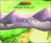
 Amid all the hullabaloo in anticipation of the upcoming Lewis and Clark Bicentennial, we mustn’t forget that Missoula is the geographic epicenter of the entire expedition. Other cities in Montana claim Lewis and Clark, but they are interlopers. The explorers spent one solid month in 1805 in the Great Falls area, but they hated every minute of it. Everything that could go wrong did go wrong. The Shoshone Indians weren’t there to provide directions; the falls were not a lone impediment but five separate cataracts with intervening cascades; the eighteen-and-a-half-mile portage across steep ravines and gullies was incredibly arduous; Meriwether Lewis’s “iron boat”—a skin-covered canoe—filled with water and sank; the last dram of a 120-gallon supply of distilled spirits disappeared on the 4th of July. All things considered, Lewis and Clark preferred Philadelphia.
 The Rocky Mountains are at the heart of the Lewis and Clark Expedition. One needn’t be a geographical genius to find a way up the Missouri River, or down the Clearwater, Snake, and Columbia. But crossing the Rockies stretched the abilities and the patience of Lewis and Clark to the utmost.
 Shoshone Chief Cameahwait turned out to be Sacagawea’s brother. Many consider the meeting to be happenstance, or coincidence. But Lewis had known what he was doing when he brought the Shoshone girl along.
 Toby may have been suffering from incipient Alzheimer’s. All the other Indians disparaged his knowledge. His initial stretch was not auspicious. Lost Trail Pass is named for Toby, who clearly didn’t know the easiest way back into Montana. “Pilot lost his way,” Clark noted ruefully.
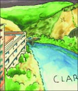
 But why did the expedition not descend the Clark Fork, which Lewis rightly figured flowed northwest to the “Tacootchetesse” or Columbia River, and which provides, via Lake Pend d’Oreille, an all-water route to the Pacific? There are three responses to this puzzle. First, Lewis had learned, however vaguely, that the Clark Fork takes a decidedly roundabout route to the ocean. It flows northwest into Lake Pend d’Oreille, out of the lake due north (as the Pend d’Oreille River) into modern Canada, and empties into the Columbia, which forms a huge letter S in modern Washington state before straightening out for the Pacific. It would be absolutely impossible to reach the ocean by this route before winter—indeed, before spring. Second, Lewis noted “the circumstance of their being no sammon” in the Bitterroot River, which indicated “that there must be a considerable fall in it below.” If salmon could not come upriver, the expedition might not be able to go down. (Kettle Falls, on the Columbia River in Washington state, was such an obstacle; it is now inundated by the waters of Lake Roosevelt behind Grand Coulee Dam.) Finally, Toby recommended a route, more or less directly east to west, over Lolo Pass and the Bitterroot Mountains to the Clearwater, Snake, and Columbia Rivers. It was the shortest and most direct route to the ocean. The Bitterroots were already covered with snow, but Lewis “felt perfectly satisfyed, that if the Indians could pass these mountains with their women and Children, that we could also pass them.” Of course, the Indians crossed in the summertime, when they could see the trail.
 Lewis was riding along a well-worn Indian trail on the north bank of the Clark Fork River. The trail later became part of the Mullan Road, through Missoula. As the late Stephen Ambrose wrote, “They passed through present-day Missoula, up today’s Broadway Street across the river from The University of Montana.” It’s another five miles “to the entrance of the CokahlaHishkit,” today’s Blackfoot River.
 Missoula is central. When Meriwether Lewis returned to St. Louis in September 1806 he immediately wrote to Thomas Jefferson. “We have discovered,” he told the president, “the most practicable rout which dose exist across the continent by means of the navigable branches of the Missouri and Columbia Rivers.” He then described “a passage by land of 340 miles from the Missouri to the Kooskooski [Clearwater River] as “the most formidable part of the tract.”